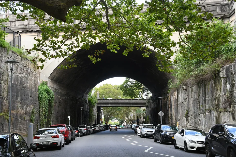
Argyle Cut
Argyle Street, The Rocks
Plan by Edward Hallen; dug by convict gangs, then the City Council. 1843 to 1859. Sandstone.
- Size
- A road through a ridge. Proportions are estimated from a photograph
- Material
- Solid sandstone, with dressed retaining walls and later concrete bridges
- Status
- State Heritage Register, 2002. Still a working road
A ridge of rock once split The Rocks from Millers Point. Carts had to go the long way round by Dawes Point, and pedestrians used crude steps over what an 1839 guide called a “precipice of considerable height”. Alexander Berry, one of the wealthiest merchants in the colony, proposed a private tolled cut. The Governor refused, and the government took on the work itself.
Convict chain gangs began by 1843. Their tools were too crude for the job, and the government gave up when it was half done. Residents had also grown uneasy about gangs working in chains in full view. The City Council finished it in 1859, with explosives and council labour. The stone they took out filled the mouth of the Tank Stream and backed the sea wall at Circular Quay.
Bridges followed in the 1860s. The Harbour Trust rearranged the streets and added the Argyle Stairs in 1911 and 1912, and the Bradfield Highway works of the 1920s widened one end, with the overhead road bridge finished in 1932. The heritage listing ranks it with Busby’s Bore and Circular Quay among the most impressive engineering works of early Sydney.
The stone
Here you can see the rock itself rather than anything made from it: bedding, stains, ferns and grooves down the bare faces. Nobody has surveyed the tool marks, so don’t assume every groove is a convict’s, since blasting left marks too. Claims that the Garrison Church and the Hero of Waterloo were built from this stone are common but unproven. The church was begun in 1840, before the Cut, and the Hero went up around 1843 to 1844, just as the Cut began.
Sources
- Argyle Cut, Wikipedia